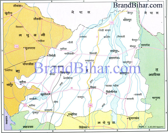
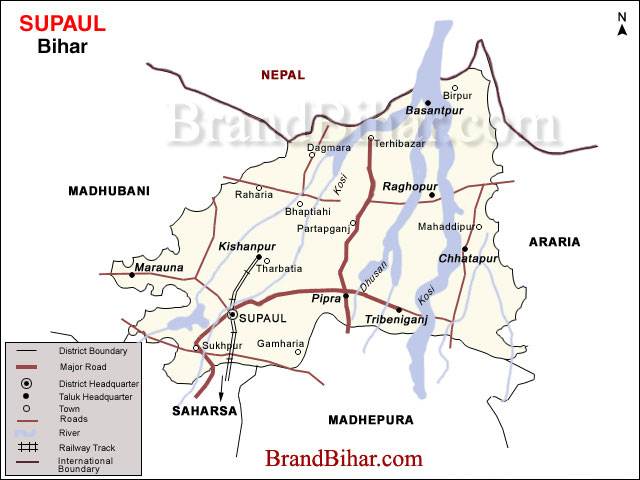
Map of Supaul

Supaul Supaul District was created from Saharsa district in the year 1991. Earlier Supaul was a subdivision. Supaul district is a part of the Kosi division. Supaul town is the administrative headquarters of the district. The district is bounded by Nepal in the north, Saharsa in the south, by Araria district in the East and on the west by Madhubani district.
Click on the Map of Supaul to see the large View of Supaul Map
River Kosi flows through Supaul. After the construction of Kosi Dam the flood situation has improved in Supaul. In the year 2008 the river Kosi changed its course and took the route it used to take 200 years ago. As a result major parts of Supaul districts were flooded. These were the worst floods since 1954. Latitude of Supaul 2507' o 260 2 N Longitude of Supaul 860 2'to 870 90' E Population of Supaul (2001) 17,45,069 Male Population of Supaul 9,08,855 Female Population of Supaul 8,36,214 Population density of Supaul 724 Per Sq. km Sex Ratio in Supaul 920 Literacy Rate in Supaul 37.80% Sub-Division in Supaul 04 Blocks in Supaul 11 Villages in Supaul 554
|